Aérea
O ofício por trás de uma imagem forte, e o que separa um 6 de um 8.
FinalFrame pontua cada foto de 0 a 10: um 6 é competente, um 8 é digno de portfólio e um 9 é de nível de exposição. Como funciona a pontuação
Ver
Aerial photography begins with a decision the ground never asks for: which of the two altitudes of seeing the frame belongs to. Straight down, the nadir view, deletes the horizon and with it every habit of landscape seeing. The world stops being scenery and becomes surface: fields turn to color blocks, roads to drawn lines, a coastline to a torn edge. It is the genre's most distinctive gift and its most demanding one, because with no horizon and no sky, the frame has nothing to lean on but graphic design: pattern, rhythm, division, the geometry that only exists from above. Tilt the camera forward into the oblique view and the world comes partway back: depth returns, the horizon returns, scale reads naturally again (a landscape photograph made from a tripod no hill could offer). Neither view is superior. The failure is drifting between them: a frame tilted a little down and a little forward, half map and half landscape, committing to neither. Decide which photograph this is before the shutter, and compose to that view's rules.
The second discipline is light, and altitude makes it stricter, not looser. From above, the terrain has almost no depth cues left except shadow, and shadow is manufactured entirely by sun angle. Low sun rakes across the ground and carves it: every dune ridge, furrow, treeline, and rooftop throws a shadow that gives the surface relief, and in a top-down frame those long shadows often are the subject (a row of trees at sunrise reads as a row of dark exclamation marks laid across gold). The same terrain under a high midday sun goes flat, a shadowless plane where texture dies and the frame has to survive on color alone. A few scenes want that flatness (turquoise shallows, graphic color fields) but they are the exceptions that prove the rule. The working default for terrain, texture, and form is the first and last hours of usable light, exactly when the ground-level photographers are out too, and for the same reason.
The third discipline is scale, because the top-down view quietly abolishes it. With no horizon and no familiar vanishing-point perspective, a frame of ridgelines could be a mountain range or a sand ripple: the viewer has no way to know. That ambiguity is a tool with two honest settings. Embrace it fully and the frame becomes abstraction, judged purely as design. Or anchor it deliberately: one boat on the water, one car on the ribbon of road, a single walker and their long shadow (an object of known size that snaps the whole frame into scale and, usually, becomes its focal point in the same stroke). What reads as neither (a vast pattern with a stray, unconsidered scale-giver cluttering one corner) is the frame that chose nothing. Altitude itself is the same kind of choice: lower and the frame is intimate, individual trees and textures; higher and it is pattern and geography. Height is the aerial photographer's focal length. Pick it for what the composition needs, not for how far the aircraft can climb.
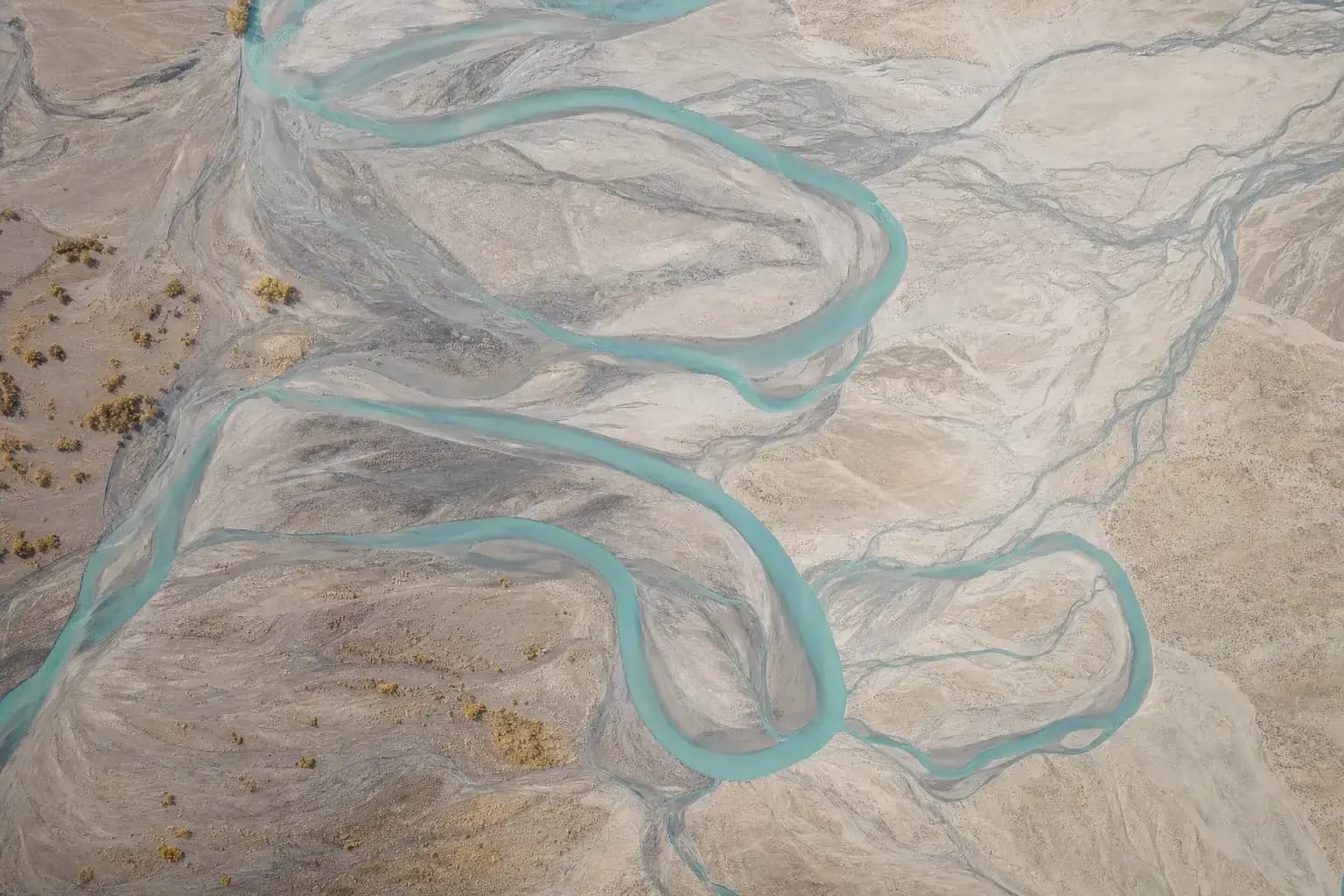
Gerada por IA
Capturar
The flight is the shoot, and it is bounded on every side. A battery buys minutes aloft, not hours; the low sun that carves the terrain is itself moving; and wind that is a breeze on the ground can be weather at altitude, costing stability, battery, and eventually the flight itself. So the craft starts before takeoff: scout the location on the map, know the two or three compositions the site offers and the sun angle each one wants, and launch with a plan, because a flight spent searching is a flight spent, and the raking light does not wait for the search to finish.
When the frame is found, stop. Bring the aircraft to a full hover, let the gimbal settle, and shoot from stillness; frames grabbed on the move, in wind, from a platform still translating, pay for the impatience in fine detail.
Part of the plan is the part that never appears in the frame: fly legally and considerately. The specific rules differ by country and change over time (registration, airspace permissions, distances from people, airports, and protected sites) so the discipline is not a number to memorize but a habit to keep: know the current local rules before the flight, keep the aircraft where it is permitted and in sight, and respect the privacy of the people below, who did not agree to be in the photograph. A frame that required breaking any of that is not a frame the genre counts.
Exposure discipline is where the sensor makes its terms known. Most camera drones carry a small sensor, and a small sensor holds less dynamic range and less high-ISO tolerance than the ground-level cameras that may share the bag, which is not a defect to lament but a condition to shoot inside. The consequences are concrete. Stay at or near base ISO whenever the light allows; the shadows of a small-sensor file do not take a hard lift gracefully. Protect the highlights (sunlit water, white rooftops, the bright sky in an oblique) because a clipped highlight is gone, while a slightly dark midtone is negotiable.
When the scene spans more range than the sensor holds (a low sun in an oblique frame is the classic case), bracket exposures from the hover and merge later; a stationary aircraft and a static landscape make bracketing nearly free. And keep the shutter honestly fast for stills: the platform is never perfectly still, and a shutter chosen as if the camera were on a tripod hands the wind the fine detail. All of this is the same sentence folded four ways: a small sensor rewards being flown in good light, and punishes the flight that treats light as post-production's problem.
Sharpness has one more term worth knowing. Many drone cameras carry a fixed aperture, and on those the exposure conversation is only shutter and ISO. Where the aperture does adjust, small sensors reach diffraction early, stopping far down begins to soften the whole frame rather than sharpen it, and depth of field is rarely the reason to try: at aerial distances, focus is effectively at infinity and everything from the treetops to the horizon sits in the same plane of sharpness.
Keep the aperture in the lens's comfortable middle, focus deliberately rather than trusting whatever the autofocus grabbed on the way up, and check sharpness at magnification on the first frame of the flight, not the last.
- ISO
- at or near base: a small sensor's shadows don't take a hard lift gracefully
- Highlights
- protect them (sunlit water, white roofs): a clip is gone; a dark midtone is negotiable
- Exceeded range
- bracket from the hover and merge: a static aircraft makes it nearly free
- Aperture
- the lens's comfortable middle: small sensors reach diffraction early; focus is ~infinity
- Shutter
- honestly fast: the platform is never perfectly still
- Shoot
- hover, let the gimbal settle, shoot from stillness, never on the move
Processar
Aerial files earn their edit in three familiar places. The first is the horizon: in an oblique frame, a tilt of even a degree reads instantly, because the horizon is a straight line against the frame edge with nothing to hide behind (level it first, before any other judgment is made). The second is haze. There is more atmosphere between an aerial camera and its subject than a ground-level frame ever deals with, and it arrives as lifted blacks, muted color, and a veil over distant detail; a measured touch of dehaze and contrast restores the scene the air diluted. Measured is the operative word: pushed hard, dehaze turns skies dirty and edges electric, and the frame starts to look processed before it looks better. The third is the small-sensor file itself: noise reduction applied selectively (smooth the sky and the flat tones, protect the fine texture the raking light paid for) and sharpening in moderation, because over-sharpened pattern shots shimmer. Where one frame's resolution runs out, stitching several from a stable hover into a panorama is legitimate craft, and bracketed merges for high-range scenes are the same honesty: assembling what the camera genuinely recorded, not inventing what it didn't.
And the honest truth, which in this genre is written in the sky: post cannot rescue the light. No amount of contrast manufactures the relief that a low sun would have carved and a midday flight didn't; dehaze recovers a veiled scene, not a flat one: shadow that was never cast cannot be dialed in. And no edit reopens the flight window: the battery that ran out two minutes before the light peaked, the wind that grounded the evening flight, the haze that never lifted (those frames were decided in the air or never existed at all). The light and the flight window are capture-limited. Editing polishes what the flight brought home; it cannot go back up.
Avaliar
Self-critique with the same lens the product uses. The FinalFrame Score is a lane-weighted blend, and the critique names ONE bottleneck, the single highest-leverage weakness in the frame, not a per-category report card. Read it as the answer to "what do I fly for next time," because that is exactly what it is.
For aerial frames in the 6–7 band, the bottleneck is most often composition or light: the frame is a high snapshot (altitude standing in for a subject, a view that proves the aircraft went up without finding the pattern, line, or anchor that organizes it) or it was flown under a flat high sun, so the terrain reads as a shadowless map with nothing for the eye to hold. At 8 and above, the bottlenecks shift to fine margins: a horizon a half-degree off level, haze handled too timidly or too hard, clipped sparkle on sunlit water, shadows lifted past what the small sensor's file could give cleanly.
- Name the frame's organizing idea in one phrase (a pattern, a line, a scale anchor, a shadow) and if the honest answer is "the view from up there," the composition isn't finished.
- Check the horizon against the frame edge, if there is one.
- Zoom to 100% in the shadows and the fine texture: is the detail clean, or is the file already showing the push?
- The harder question, the one that decides the band: do the shadows in the frame have length and direction (was this flown in light that shaped the ground, or in light that merely lit it)?
Por que um 6 não é um 8
The 6 is correct, and correctness is its ceiling. The exposure holds, the horizon is roughly level, the view is genuinely elevated and momentarily impressive the way any view from altitude is. But the frame is organized by nothing: it is coverage, the landscape recorded from above rather than composed from above, with no pattern isolated, no line leading, no anchor giving the vastness a size. The light is whenever-light: high, shadowless, the terrain flattened into a colored map. The novelty of altitude is doing all the work, and novelty is the one element of a photograph that evaporates on the second look. The diagnostic tell: the frame answers "what does this place look like from above", and no other question.
An 8 is a photograph that happens to have been made in the air. The view is committed: a clean nadir abstraction or a purposeful oblique, not a hedge between them. The frame is built on a graphic idea that only altitude could see: the rhythm of the field lines, the one red roof in a grid of grey ones, the boat and its wake cutting a dark harbor, the shadows of the trees laid longer than the trees. The light is chosen light (low, raking, giving the surface relief and the shadows a direction) and the file is clean because the flight was flown when the light was worth the battery. Scale is handled on purpose: anchored and immediate, or abandoned entirely for abstraction. The 6 shows that the photographer's camera got up there. The 8 shows what the place is from up there, and that difference is decided before takeoff, in the sun angle the flight was planned around and the idea the frame was built on.
So fly it again, for the one thing the critique named. If it was the light, plan the next flight for the first or last hour and watch what the same terrain does when the shadows stretch; if it was composition, spend the scout finding the one pattern or anchor worth building on, and spend the battery on that frame instead of the search; if it was the file, drop the ISO, protect the highlights, bracket from a settled hover. If the fix is real, you'll see it on the first review of the take: the next critique names a different limit, and the FinalFrame Score has room to move, because the frame has stopped paying for the same flat noon. And if the same bottleneck is named again, that is information, not indictment. Aerial is the genre most completely at the mercy of a coincidence: the light, the weather, and the flight window all have to open at once, over ground that actually organizes from above, and some evenings the wind grounds the aircraft at golden hour, some mornings the haze never lifts, and some locations simply hold no pattern at altitude, however precisely they are flown. Sometimes the repeat is naming the site or the season, not the technique: the field that is a checkerboard at harvest is a grey blank in March. Read it as a description of what the sky and the ground offered that flight, then plan the next one, because the light that didn't come today is on tomorrow's forecast, and the battery charges overnight.
Lições relacionadas
Veja na sua própria foto
A forma mais rápida de entender a pontuação é ler uma sobre uma foto que você conhece bem.
Criticar uma foto